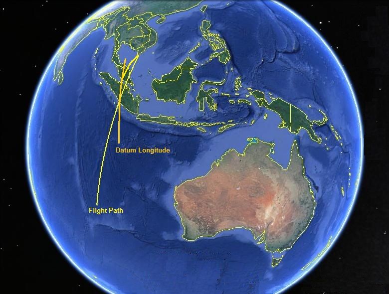
From the Burst Frequency Chart posted above i would reinterpret the path of MH370 as follows with an orange coloured datum line through Longitude 101.33' E.
However don't forget that the INMARSAT satellite was geosynchronous and not geostationary, therefore it also wobbles around the equator in a small figure of eight pattern which slightly disturbed the Burst Frequency Offset during the time MH370 was airborne too.
Without this slight wobble there would not have been any ability to measure the Doppler shift at all.
To get a correct scaling of the inverted (corrected) data you actually need to vertically compress the data up to about 19:10 UTC.
At around 19:40 INMARSAT in its wobble began to track south and west @ 50 kilometres per hour which actually tightens the curve of the plotted pings across the southern Indian Ocean.
I sincerely urge anybody involved with the search for the seabed wreck to start the sonar search at 3,000nm distant from Con Son Island in the South China Sea, where it intersects the plotted ping line.